Originally published 24 October 1988
On December 21, 1620, the Pilgrims alighted from the Mayflower at Plymouth, and according to tradition made their landfall on a rock that has become enshrined in American folklore. Plymouth Rock, like the Pilgrims themselves, was a traveler to the Massachusetts shore, a boulder plucked up by moving ice at a location far to the north and dropped at the place where the Pilgrims found it.
Erratic boulders, boulders that are dissimilar to the bedrock of the region in which they are found, intrigued geologists for a long time before the reality of the ice ages was recognized. Such boulders are common over many parts of the British isles, northern Europe, and the northern parts of North America.
Mystery boulders
In 1825, Peter Dobson of Vernon, Conn., proposed that the boulders were carried to their present positions by drifting icebergs at a time when the sea covered the land, probably during the flood of Noah. According to Dobson, when rock-bearing icebergs drifted south into warm water and melted, they dropped their passenger boulders in odd places. The influential British geologist Charles Lyell also believed icebergs were responsible for moving the out-of-place rocks. The drifting iceberg theory became widely popular, and erratic boulders, and other alien sediments associated with them, came to be known as drift.
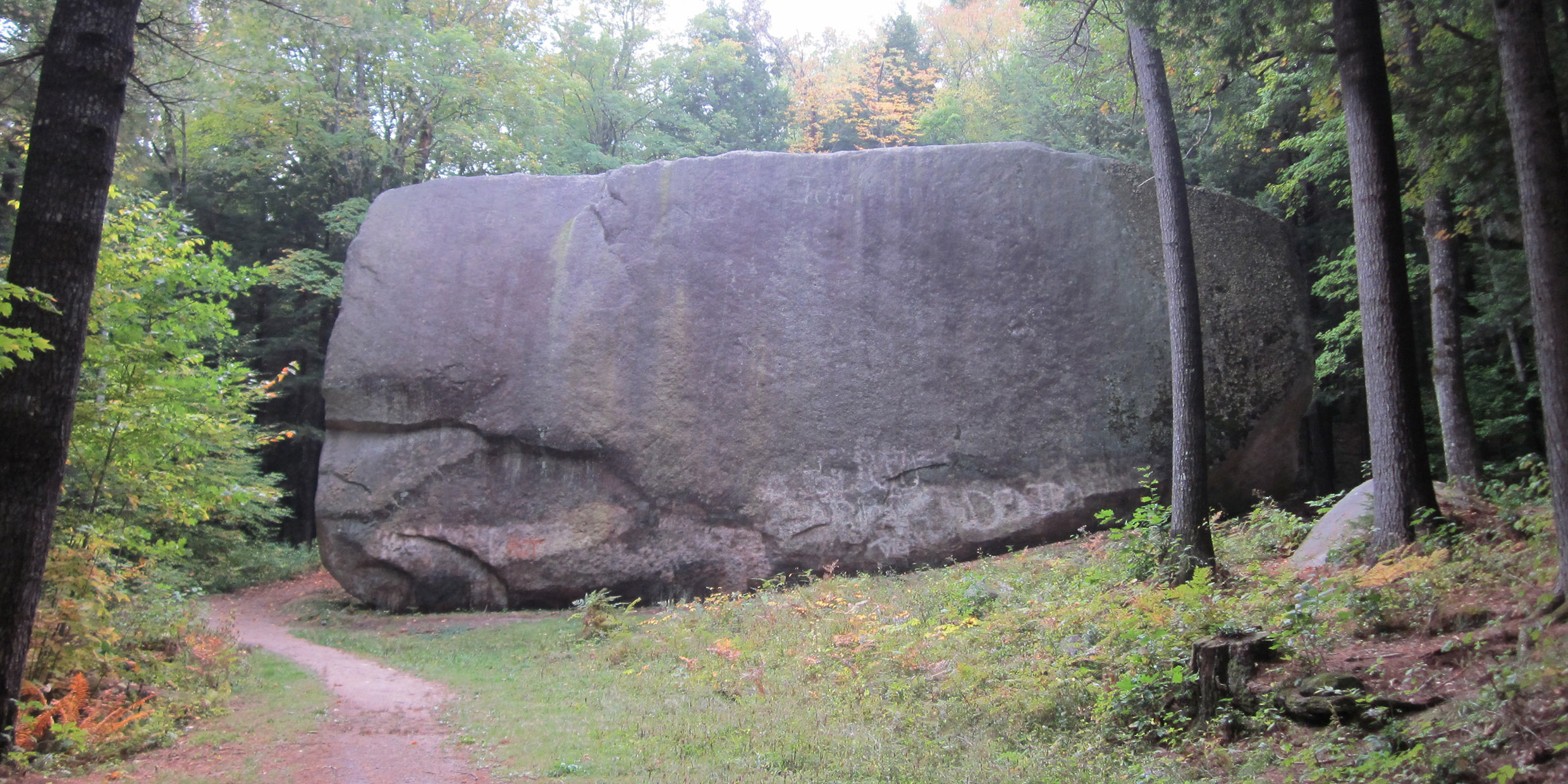
We no longer believe that “drift” drifted. There are puzzles that the iceberg theory failed to answer. The largest erratic boulder in our region, and one of the largest in the world, is at Madison, N.H., just south of Conway. It is 83 feet long and weighs 5,000 tons, as much as an ocean freighter. A mineralogical examination of the boulder shows that its place of origin was a bedrock outcrop two miles north of the place where it is presently found. No conceivable combination rising seas and drifting icebergs satisfactorily accounts for the breaking off and transportation of this huge chunk of the Earth’s crust.
During the middle of the 19th century an alternative account of the erratics was composed by Jean de Charpentier, Louis Agassiz, and other astute observers. These scientists guessed that at some time in the not so distant past parts of the northern continents were spanned by vast sheets of moving ice. The exploration of the Greenland Ice Sheet in the 1850s helped convince geologists that continent-spanning glaciers can and do exist. The two-mile-thick Greenland Ice Sheet grows as its center, where it accumulates ice in the form of snow, and moves outward under the influence of its own weight. It is clearly a thing of sufficient power to pick up and carry the ship-sized Madison Boulder.
Other impressive New England erratics that are easily accessible to the traveler are Bartlett Boulder and Sawyer Rock on Rte. 302 near Bartlett Station, N.H., Monhegan Rock north of Montville, Conn., and Enos Rock in Eastham on Cape Cod. Anyone who doubts the reality of the ice ages need only look at one of these monstrous displaced stones to be converted.
On an outcrop of dark volcanic rock not far from my home in Easton sit half-a-dozen erratic boulders, some weighing as much as 20 tons, of a coarse-grained pink granite called granodiorite. Where did the glistening pink boulders come from? I decided to see if I could find their source.
The bedrock on which the boulders sit is scratched and polished by ice. The scratches — called striae by geologists — indicate the direction the ice was moving. Other bedrock outcrops in the area are also scratched. It is not hard to follow the scratches upstream. What I was looking for was a hill where coarse-grained pink granodiorite is exposed on the southern slope. Moving ice has a way of breaking off boulders from the downstream side of a hill and carrying them along.
Following the trail
Like an Indian trail of bent twigs, the scratches on the rocks led me north for several miles, out of Easton into the town of Stoughton, where at last I found what I was looking for, a south-facing outcrop suitable as the source for my erratics, rock that under the hand magnifier was exactly identical to the boulders — and that’s where I stopped.
But the trail goes on. The scratches lead north from Stoughton, through the western suburbs of Boston, up the valley of the Merrimac River, veering slightly westward near Concord, N.H., toward the Connecticut River, where they pass into Vermont, and on into Canada.
It is possible to find bits of glacial drift in Easton that had their origin anywhere along that line of scratches, perhaps something as small as a grain of sand that was once part of a boulder plucked in Canada and pulverized by moving ice. Pieces of New Hampshire, Vermont, and Quebec litter the ground beneath my feet.
The trail of scratches leads south too, out of Easton, through Wareham, under Buzzard’s Bay and Vineyard Sound (which, of course, were not bodies of water when the ice lay upon the land), to Martha’s Vineyard, the southern terminus of the glacier, were even now it might be possible to find a piece of Easton rock dropped there by the ice.
For tens of thousands of years, a vast glacier moved upon North America, tearing, plucking, grinding, scratching. All of this abraded material was carried by the ice, and when at last the climate warmed and the ice melted, the burden it carried was dropped in place — grit, pebbles, boulders, drift that did not drift — the scrapings of a continent left in my backyard.


