Originally published 19 February 1990
In chalky rock beneath the English Channel, British and French tunneling machines are burrowing toward each other, like moles, from opposite shores.
When they meet later this year, somewhere under the middle of the Channel, an age old dream will be realized — Britain will be physically bound to Europe.
The Channel Tunnel, or “Chunnel,” consists of twin parallel railway tunnels 30 miles long, with a smaller service tunnel between them. Twenty-two miles of the Chunnel lie under the floor of the sea.
We have heard lots about the design of the Chunnel, and the politics, and the finance, and even about the men who work in the hole. The untold story is the work of the surveyors whose responsibility it is to ensure that the British mole and the French mole meet nose to nose.
Not a simple task
This task is not as simple as one might think. For one thing, the tunnel is not a straight line from Dover to Calais. It wiggles both horizontally and vertically to stay in the proper sort of rock and avoid known faults and fissures.
The favored rock is called the chalk marl stratum. It is soft and relatively impermeable to water, two conditions that allow excavation to be carried out at high speed.
The first task of the surveyors was to establish a surface network of fixed markers on the British and French shores, and sight-line links across the Channel connecting the two grids. The biggest problem lies in establishing the vertical (elevation) relationship between the British and French survey grids. Figuring out how high each site is in relation to the other is difficult, because the atmosphere refracts, or bends, light over the line-of-sight distance between the two sides of the channel. And because of winds, tides, gravity, surveyors can’t even be sure that sea level is exactly the same on the two shores.
Next comes the task of extending the surface grid into the tunnel, and of keeping track of where the head of the tunnel lies as it wriggles under the sea. This involves a tour de force of angle and distance measurements with lasers and computers. Calculations and instruments are checked, double-checked, and triple-checked.
The potential for embarrassment is staggering. If the British and French tunnels meet out of kilter there will be a lot of red-faced engineers.
Just in case, the service tunnel will go for breakthrough well in advance of the main tunnels, so that adjustments can be made if errors have occurred.
Ancient wonder of engineering
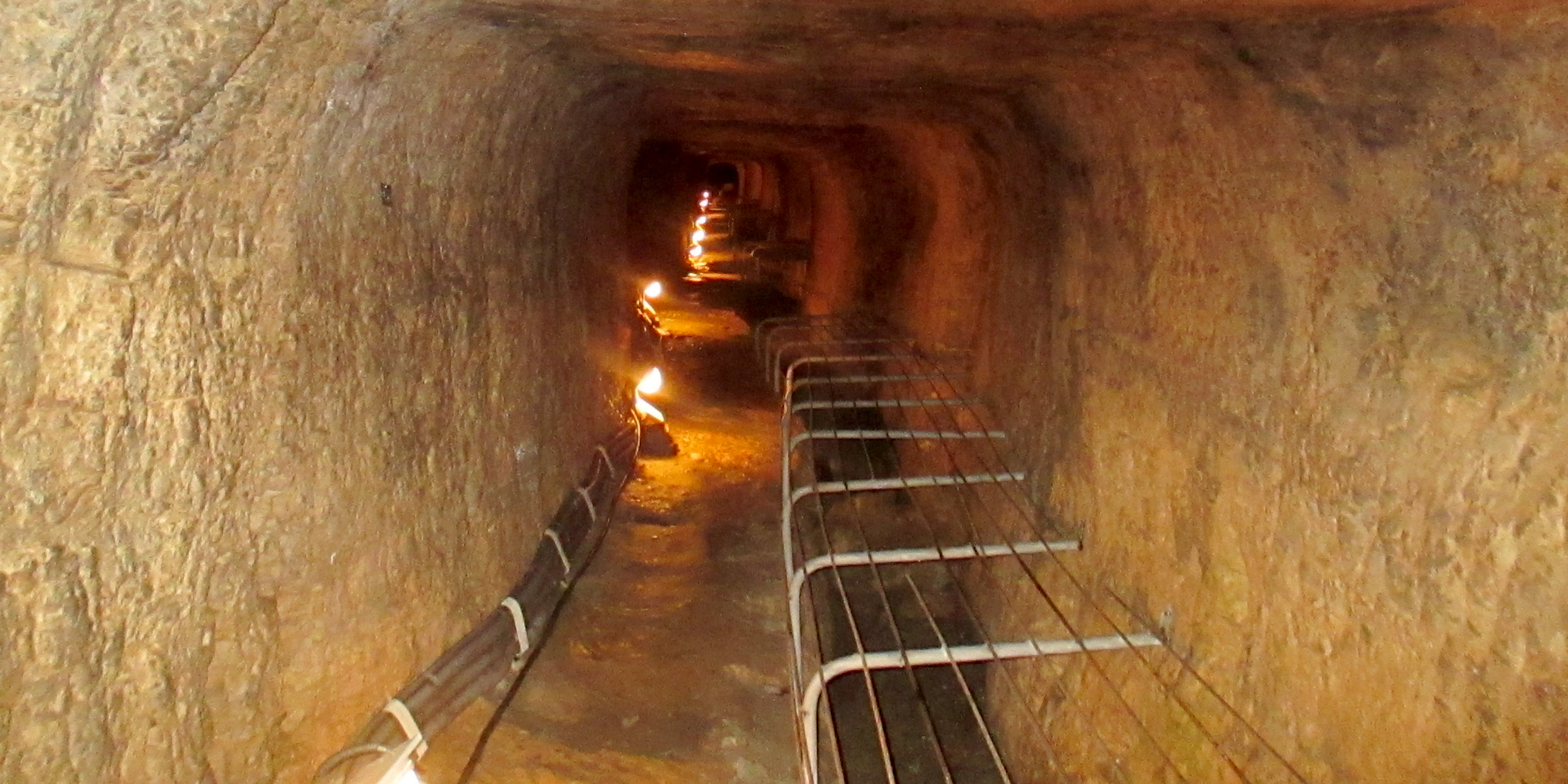
The advantage of digging from both ends at once is speed, a tactic first adopted (so far as we know) by the Greek engineer Eupalinos. Some 2,500 years ago, the Greek tyrant Polycrates engaged the services of Eupalinos to construct a 3400-foot tunnel through Mt. Castro on the island of Samos. The tunnel would supply the fortified city of Samos with a reliable water supply hidden from potential invaders.
Eupalinos chose to dig from both sides of the mountain at once. His tunnel remains intact, one of the little-known wonders of the ancient world.
The Greek tunnel was cut in pure limestone, with hammer and chisels, by the light of oil lamps. It is six-foot square, just large enough to allow workers carrying rubble out of the tunnel to pass those returning with empty baskets.
About halfway through the mountain there is a sharp jag in the tunnel’s course that indicates where two teams of diggers met, not quite dead on, but close enough to have heard each other chipping at the rock.
How did Eupalinos do it? His tunnel is only two-thirds of a mile long, compared with the 22-mile Chunnel, and dead straight rather than wriggly, but with the technology available in his time his challenge was no less demanding.
It is impossible to know his survey methods, but after careful examination of the site, science historian June Goodfield suggested a possible scenario in the June 1964 issue of Scientific American.
First, Eupalinos ran a series of vertical poles up and over the mountain, from one portal to the other, assuring alignment by sighting along each pair of poles to the next. This established the line of the tunnel. The line was extended beyond the portals of the tunnel, and then back into the tunnel itself.
Vertical alignment was more difficult, especially as the tunnel required a slope so that water would flow through it. There is no place where one can stand and see both portals, and the sea, which could have afforded a natural reference horizon, is not visible from the northern portal. Perhaps Eupalinos sighted from pole to pole over the mountain with some form of water level, measuring differences in elevations along the poles.
When the last intervening bit of rock was hewn away and light shone through from end to end, Eupalinos was undoubtedly feted by by the citizens of Samos, and (we hope) amply rewarded by his employer. British and French Chunnel engineers can only hope to be as skillful — or as lucky.
With much fanfare, the British and French service tunnels were connected underneath the Channel on December 1, 1990. The main channel tunnels were opened to travel in 1994. ‑Ed.


