Originally published 23 November 1987
Bostonians anticipate the construction of a depressed Central Artery and third harbor tunnel with something akin to morbid fascination and stark terror.
It is estimated that the combined superproject will take 11 years and cost more than $3 billion dollars. Even more than time and money, what causes consternation is the prospect of a gaping wound in the heart of the city, hundreds of huge trucks rumbling through city streets bearing a mountain of excavated earth, colossal traffic jams, an airport made as inaccessible as if it were on the moon, and neighborhoods as shaken and covered with dust as if they were perched on the side of an active volcano.
As we cope with chaos, it may help to keep one’s eye on the distant prize — a public amenity that was worth all the trouble. The Central Artery/third tunnel project is not the first time Bostonians have accepted temporary trauma in pursuit of a permanent good. A city that is gracious and livable has its price in dollars, curses, and tears.
My source for what follows is a superb book recently published by MIT Press: Landmarks in American Civil Engineering by Daniel L. Schodek. The works described in the book are those that the civil engineering profession in America regards as its most remarkable and important achievements.
Sixteen of the “landmark” projects are located in New England. They range from the Hoosac Tunnel in the Berkshires to the Cog Railway on Mount Washington, from the long-derelict Middlesex Canal to the century-old and still functional Minot Ledge Lighthouse at Cohasset.
Familiar hue and cry
Two of the projects are of particular relevance to the Central Artery/third harbor tunnel project: the Boston subway, the first in North America, inaugurated in 1897, and the Charles River Basin, completed in 1910. Both projects disrupted the life of the city for an extended period; both were vigorously protested in the planning stages.
Toward the end of the 19th century, the narrow, winding streets of colonial Boston had become a traffic nightmare. Jams of streetcars, horse-drawn wagons, and carriages on Tremont Street sometimes rivaled present-day backups on the Artery. After extensive study and public hearings, a newly-appointed Rapid Transit Commission decided that the appropriate solution was an underground rail line linking Haymarket Square with the Public Garden/Warrenton Street areas. Most of the line would lie under Tremont Street, and would be constructed by the cut-and-cover method.
Construction began in March 1895, but was soon halted by injunctions initiated by citizen groups opposed to the subway. An action by the Supreme Judicial Court was required before the work could proceed. Even then, construction was slowed by the requirement that two-thirds of the roadway on Tremont Street and all of the car tracks remain open during peak traffic times.
Photographs of work in progress portray a vivid picture of the massive disruption caused by excavation of the subway line. For several years the heart of the city resembled a war zone. But when the line was opened for service in 1897 it was an instant success. More than 50 million passengers rode the subway during its first year of operation. The Tremont Street stretch of subway remains a key element of Boston’s transit system.
Attractive new basin
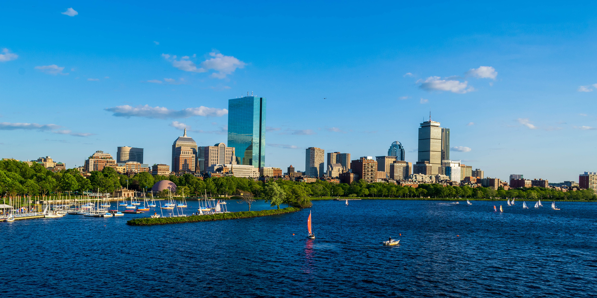
It is difficult to imagine the Boston of today without the graceful public amenities of the Charles River Basin. To my mind, no view of the city is more attractive than that from Harvard Bridge near MIT, across a sun-flecked fresh-water lagoon bright with white sails, to the green arc of Storrow Park and the gleaming golden dome of the State House on Beacon Hill.
Prior to 1903 that same prospect was rather less enchanting. The Charles River between Boston and Cambridge was then a malodorous combination of saltwater marsh and mudflat, swept twice daily by tides from Boston Harbor, and a receptacle for the discharge of sewage from the residential neighborhoods of the Back Bay.
Nevertheless, a proposal to dam the Charles and turn the lower river into a freshwater lake met with passionate opposition. Landowners in the Back Bay, motivated chiefly by commercial concerns, roused public indignation by predicting that the dam would create a huge, excrement-filled lake, uncleansed by tides.
Engineering studies assured that a freshwater lagoon would easily rid itself of contaminants. Further, a massive lock was included in the design of the new dam at least partly to mollify objectors who maintained that the project would isolate the commercial enterprises of the Charles River area from the sea.
Enabling legislation was passed by the legislature in 1903, and the project was completed in 1910. The Charles River Basin and its recreational and cultural amenities are now universally recognized as a masterpiece of enlightened urban planning.
The Tremont Street subway and Charles River Basin are examples of civil engineering at its best, huge projects competently undertaken on behalf of the public good. In both cases, long-range vision won out over short-sighted objections.
Time will tell whether the Central Artery/third tunnel project turns out to be, as its critics say, a $3 billion dollar boondoggle — or, as the planners hope, a new “landmark” of civil engineering.
Boston’s Central Artery/third tunnel project, or “Big Dig,” was eventually completed in 2007 after 16 years of construction and a final price tag of over $8 billion — the most expensive highway project in US history. ‑Ed.


