Originally published 31 July 1989
What is science?
Here’s a definition of science from a [1989] essay in the New York Times Book Review: “Science applies rational methods — the ‘scientific method’ — to determine, by suitable test, control or juxtaposition of observations, whether the hypotheses arrived at to help explain the observational data, and to render them more comprehensible, are provisionally more credible than any known rival hypotheses.”
You’ve got to admire anyone with the audacity to define science in one sentence, in this case psychiatrist Robert Wallerstein. And his definition is probably about as good as you can get in 43 words. But I don’t trust it. I don’t trust any definition of science that can be squeezed into a single sentence, and certainly not a sentence that takes itself so seriously.
Definitions like Wallerstein’s give science a bad name. They make doing science sound unbelievably dull, and leave out all the good bits. The fun of science comes in collecting “the observational data,” inventing “the hypotheses,” and coming up with “suitable tests.” No single sentence can capture the richness of those activities.
Here are examples of science that can’t be packed into a sentence. I might have picked examples from any field of science; these have to do with geology, and in particular with the theory of seafloor spreading.
Mapping with dynamite
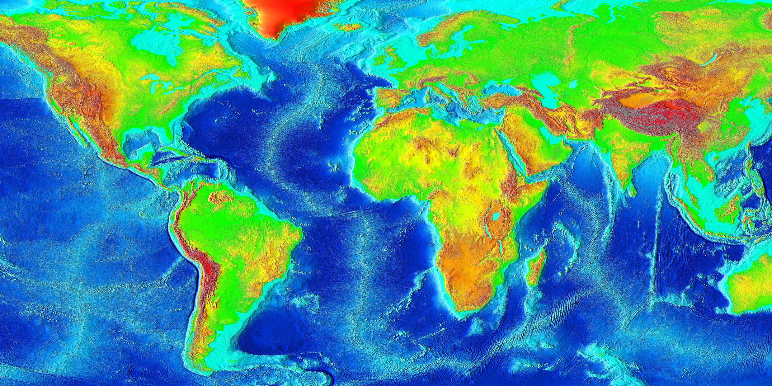
First, the “observational data.”
At the end of World War II, three-quarters of the Earth’s surface — the part covered by water — was terra incognito. Maurice Ewing, an American geophysicist, began mapping the ocean floor. He did it by tossing charges of dynamite off the stern of a ship. The dynamite exploded with a bang. The sound bounced off the bottom of the sea and returned to the ship, where it was recorded by hydrophones dangling in the water. The sound waves also penetrated layers of sediment on the ocean floor, and bounced off the boundaries between the layers. All of these returning waves were analyzed to produce maps of the sea floors and their sediments. It was hard, dangerous, exhilarating work, replete with surprises. Ewing was lucky not to blow himself sky-high. This was data collection in heroic style.
What Ewing found on the ocean floor cried out for explanation: continental slopes, abyssal plains, transform faults, trenches, mid-ocean ridges, and rifts.
Enter Princeton geologist Harry Hess and his “hypothesis.” Only Hess didn’t call it a hypothesis. It was too wild an idea for that. He called it “geopoetry.”
Hess proposed that the Earth’s crust is constantly growing at the mid-ocean ridges and consumed at the ocean trenches. No oceanic crust anywhere on Earth is more than a few hundred million years old, said Hess. Instead, oceanic crust is recycled through the interior of the Earth, moving laterally away from the ridges to the trenches, dragging continents along. “Whole realms of previously unrelated facts fall into a regular pattern,” wrote Hess excitedly, including the seafloor features mapped by Ewing.
Of course, Hess’s crazy new hypothesis — called seafloor spreading — didn’t spring out of nowhere. Many other scientists had seen pieces of the picture. The clues were there for anyone to see. All it took was a flash of “poetic” insight to pull it together.
But how could the the hypothesis be given a “suitable test”? The crustal motions suggested by Hess were too slow to observe directly. In 1962 British geologist Drummond Matthews returned from a research cruise in the Indian Ocean with data on peculiar variations in the Earth’s magnetic field. He gave the data to a new graduate student, Fred Vine, for analysis.
Vine had heard about seafloor spreading. And he knew about the recent discovery of polarity reversals of the Earth’s magnetic field. He put the two things together and explained Matthew’s data. As new crust forms at the mid-ocean ridges it takes on the character of the Earth’s magnetic field at the time of formation, then moves away from the ridge with the spreading ocean floor. When the Earth’s magnetic field flips, reversing north and south poles, the magnetization of new sea floor rock also changes. Vine and Matthews boldly proposed that the entire oceanic crust of the Earth would show bands of normal and reversed magnetization parallel to the ridges and symmetric about them. The proposal, said Vine later, was “at least a little presumptuous.”
The right mix
And, of course, the worldwide magnetic variations turned out to be exactly as Vine and Matthews proposed. The rest is history. Within a few years the science of geology was revolutionized. Continents drift. Oceanic crust is recycled. The planet is a dynamic engine churning with activity.
Ewing, Hess, Vine, and Matthews are only part of the story. But they illustrate the best part of doing science, the part that can’t be squeezed into a definition. Everyone agrees there is something called “the scientific method,” but it’s not easy to define. Good science is a mix of energy, insight, courage, luck, brains, friends, competitiveness, money (or sometimes the lack of it), equipment, imagination, and being at the right place at the right time — and that’s just for starters.
So what is science? How about this: Science is whatever works. Or this: Science is what scientists do. Nope, neither definition is quite satisfactory. I’m not sure I can define science, and certainly not in a sentence. But I know it when I see it.


