Originally published 30 July 1984
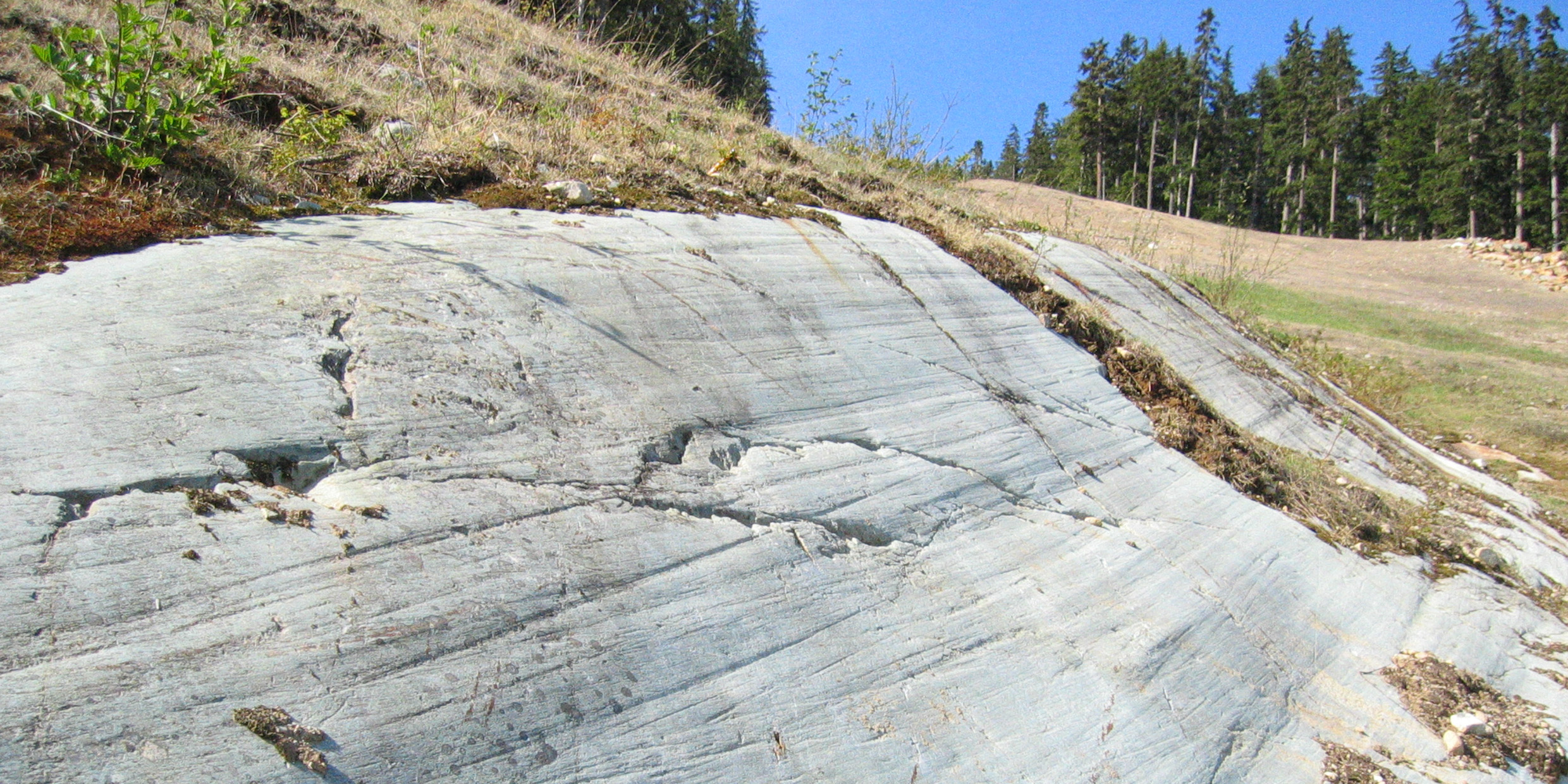
Set a geologist down anywhere in New England and somewhere nearby he will show you the work of ice. Eighteen thousand years ago all of New England lay beneath a half-mile-thick sheet of ice, part of a continent-spanning glacier that reached from the deeply indented coast of the Pacific Northwest to the gently sloping continental shelf of New England. The ice that lay upon the land was moving ice, pushing south from centers of accumulation in Canada, pressed forward by its own weight, rounding valleys, planing mountains, scouring and plucking, abrading and transporting, building at the glacier’s southern margin ridges of debris that had been scraped from the surface of a continent and dumped at the place where the ice melted.
I was reminded of those icebound times today. On a walk of only a mile near my home in Easton, I saw varied and conclusive evidence of the age of ice. I saw outcrops of bedrock ground flat and polished as if by powerful machinery. I saw slabs of rock as big as houses that had been ripped from the top of a hill and scattered helter-skelter like a child’s blocks. I saw a quarry of sand and gravel, finely graded, far from any shore, where meltwater flowing out from the edge of a glacier had deposited in Massachusetts bits and pieces of New Hampshire and Quebec.
Stages of deglaciation
For most of the past several million years the Earth’s climate has been colder than today. Throughout most of that time, extensive areas of the northern continents were covered with ice, even as Antarctica and Greenland are covered today. At roughly 100,000-year intervals, that long glacial regime was interrupted by periods of warming. These cyclical warm spells seem to be related to minor variations in the Earth’s orbital posture relative to the Sun. We are apparently in such an interlude today. The present climate is warmer than at any time in the past 100,000 years.
Bill Ruddiman of the Lamont-Doherty Earth Observatory in Palisades, N.Y., has recently completed a series of maps that reconstruct in graphic detail the stages of deglaciation since the peak of the last ice age. Ruddiman’s maps are based on the work of investigators in many fields. They summarize data derived from counts of planktonic microfossils in deep-sea sediments, from the radioactive dating of glacial lake and bog deposits, and from analysis of pollen deposited in lakes and bogs south of the ice sheets. The maps provide the most detailed picture yet of late-glacial climatic history, including vegetation boundaries on the northern continents and ocean temperatures in the North Atlantic.
Only 18,000 years ago, ice sheets on the northern continents reached half way to the equator. In North America, the line of maximum glacial advance lay approximately along the courses of the present Ohio and Missouri Rivers. In New England, the ice reached to a line defined by Long Island, Block Island, Martha’s Vineyard and Nantucket. Those islands are creations of the ice, moraines of erosional debris deposited at the melting southern margine of the great ice sheet. At the time the material was deposited, these ridges of debris stood on dry land. With so much frozen water stored up on the continents, sea levels were much lower than at present, and New England’s shoreline was far to the south and east of its present location.
By 14,000 years ago, a modest warming had begun and the ice pulled back somewhat from its line of maximum advance. Southern New England became ice free. But a chill still lay upon the land. Most of North America north of the Gulf of Mexico was characterized by Arctic-like tundra and boreal forest.
Glaciers in retreat
By 12,000 years ago, the continental glaciers were in full retreat. In the east, the ice melted back to approximately the line of the St. Lawrence River. Only scattered remnants of the once unbroken ice sheet lingered in the mountains of western Canada. An ice-free corridor opened up between Alaska and the rest of North America, allowing a wave of human migration to enter the continent from Siberia.
By 9000 years ago, climate on the North American continent was approaching present conditions. A large ice sheet still blanketed much of eastern Canada, but glaciers in the west receded to alpine valleys. Deciduous and coniferous forests advanced northward even more rapidly than the ice retreated, and vegetation boundaries in eastern North America were not much different than today.
By 7000 years ago, only small remnants of the original continent-spanning ice sheet lay on parts of northeastern Canada. Some parts of North America were even warmer than today. The Greenland ice cap and Arctic sea ice stood as the last major reminders of the age of ice. Sea levels rose to essentially modern levels, turning morainal deposits on the coastal plains of New England into offshore islands.


